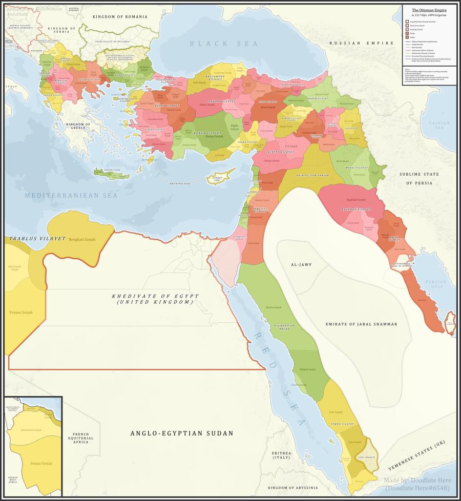
Ottoman Empire Administrative Divisions, 1899
A detailed map showing the Ottoman Empire and its dependencies, including its administrative divisions, in 1899 CE (1317 Hijri).
References:
The sources that back up the maps are as follows:
- Pavet de Courteille, Abel (1876). État présent de l'empire ottoman (in French). J. Dumaine. pp. 91–96. (for Yemen): https://books.google.com.eg/books/about/%C3%89tat_pr%C3%A9sent_de_l_empire_ottoman.html?id=ZqsCAAAAYAAJ&redir_esc=y ;
- http://tarihvemedeniyet.org/.../trablus-garb-vilayeti.html for Tripolitania;
- http://tarihvemedeniyet.org/2009/10/bosna-vilayeti.html for Bosnia;
- https://www.nsi.bg/nrnm/index.php?i=1&ezik=en for eastern Rumelia;
- http://hdl.loc.gov/loc.gmd/g7431f.ct002181 (Rest of Ottoman subdivisions, taken from the United States Library of Congress's Geography & Map Division, digital ID g7431f.ct002181).
👍5